Tabriz city

Tabriz city

Sunday, May 7, 2017

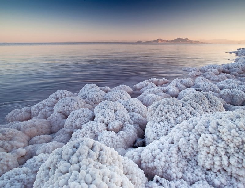
Orumiye lake

Lake Urmia (Persian: دریاچه ارومیه‎‎,Daryāche-ye Orūmiye; Azerbaijani: اورمیا ﮔﺆﻟﻮ, Urmiya gölü) is an endorheic salt lakein Iran.[3][4] The lake is between the provinces of East Azerbaijan and West Azerbaijan in Iran, and west of the southern portion of the Caspian Sea. At its greatest extent, it was the largest lake in the Middle East and the sixth-largestsaltwater lake on Earth, with a surface area of approximately 5,200 km2 (2,000 sq mi), a length of 140 km (87 mi), a width of 55 km (34 mi), and a maximum depth of 16 m (52 ft).[5] The lake has shrunk to 10% of its former size due to damming of the rivers that flow into it, and the pumping ofgroundwater from the surrounding area.[6]
Lake Urmia, along with its once approximately 102 islands, is protected as a national park by the Iranian Department of Environment.

Shahar yeri

shahar yeri is a Neolithic and Bronze Age megalithic monument located near Meshkin shahr in the Iran
shahar yeri, in a 400-hectare area, is located near Pirazman village of Meshkin Shahr, in Ardabil province, in which some layers belonging to (8000 years ago) have been identified so far.
This area includes 280 Sngafrasht ancient antiquity AD is estimated to be more than 8 thousand years ago during the late Bronze Age and the Neolithic period dating back these areas and Chalcolithic and Early Iron is concerned. This Sngafrashtha with different heights from 70 to 360 cm, most of which are engraved in human forms. Azerbaijan has been found.

Babak castle

Pāpak Fort (Persian: دژ بابک‎‎) or Babak Castle[1](Persian: قلعه بابک‎‎), also known as the Immortal Castle or Republic Castle, is a large citadel and National Symbol of Iranians on the top of a mountain in theArasbaran forests, which is located 6 km southwest ofKalibar City in northwestern Iran. It has been identified as the stronghold of Pāpak Khorramdin, the leader of the Khurramites in Azarbaijan who fought the Islamic caliphate of Abbassids.[1] Iranian Azarbaijanis gather at Babak Castle during the first weekend in July for the annual commemoration of Babak Khorramdin.[2]
The ascent to the Castle is not for the infirm, elderly, or those afraid of heights. A series of long, and in places, broken steps lead the traveler to the top of a hill from where there are several choices for further ascent. The easiest is straight in front of the steps and consists of a long dirt track. As there are no sign posts towards the Castle, walk towards the peak on your left hand side but do not leave the dirt track. You will need hiking boots, a sun hat, plenty of water, and at least 3 hours for the climb, and 2 hours for the descent. At the end of the dirt track, turn left onto the rocky mountain side, and beware of slipping. The first of sign of the ruins will appear on your left, but do not become too complacent: the actual Castle is another 2 peaks march away. The first peak offers spectacular views of the Castl. After ascending a second peak, with its own ruins, you will see the Castle perched on top a jagged cliff. Ascending the Castle steps is a dangerous process, as there are sheer cliffs on your right hand side, and no protective rails or fences to prevent a fall of several hundred meters. Take extreme care of the edge, and hold on to your children. Once you have climbed the pinnacle of the cliff, you will truly appreciated the amazing effort in building and maintaining a fort at this altitude. Unfortunately, you will also have to tolerate the graffiti on the ancient walls, and young people playing chicken on top of the Castle walls. Under no circumstances should you even consider climbing these walls: first, this can damage the ancient structure, and second, a fall of several thousands of meters would lead to certain death. Nevertheless, the experience afterward is well worth the strenuous climb: the surrounding Arasbaran oak forest, jagged cliffs, mountains in the distance, and the history of the place combine to create one of Iran's most beautiful vistas. The castle, built on 2300-2600 meter heights, surrounded by gorges as deep as 400 to 600 meters, is believed to belong to the Parthian dynasty and modified under the Sasanid dynasty. To reach the castle, one has to trek a tortuous and narrow passageway and then cross a corridor-shaped temple, 200 meters in lengths.

Kandovan village

This village exemplifies manmade cliff dwellings which are still inhabited. The troglodyte homes, excavated inside volcanic rocks and tuffs similar to dwellings in the Turkish region of Cappadocia, are locally called "Karaan". Karaans were cut into the Lahars (volcanic mudflow or debris flow) ofMount Sahand. The cone form of the houses is the result of lahar flow consisting of porous round and angular pumice together with other volcanic particles that were positioned in a grey acidic matrix. After the eruption of Sahand these materials were naturally moved and formed the rocks of Kandovan. Around the village the thickness of this formation exceeds 100 m and with time due to water erosion the cone shaped cliffs were formed.[2]At the 2006 census, the village population was 601, in 168 families.[3]


Edit

Saint stepanos monastery

The Saint Stepanos Monastery, 15 km northwest of Jolfa city, East Azerbaijan Province, northwest of Iran, is an Armenian monastery, situated in a deep canyon along the Aras River on the Iranian side of the border between Nakhchivan Autonomous Republic and Iran. It was built in the 9th century and rebuilt in the Safavid era due to numerous earthquakes that had severely damaged the building.